


North Rushville Precinct, Sheridan County, Nebraska
About
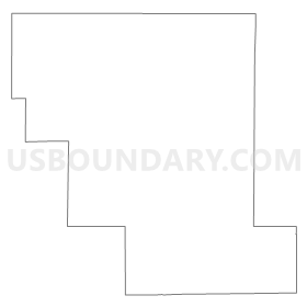
Outline
Summary
| Unique Area Identifier | 613946 |
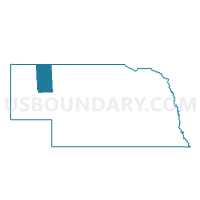
| Name | North Rushville Precinct |
| County | Sheridan County |
| State | Nebraska |
| Area (square miles) | 281.51 |
| Land Area (square miles) | 281.42 |
| Water Area (square miles) | 0.09 |
| % of Land Area | 99.97 |
| % of Water Area | 0.03 |
| Latitude of the Internal Point | 42.86340610 |
| Longtitude of the Internal Point | -102.49291460 |
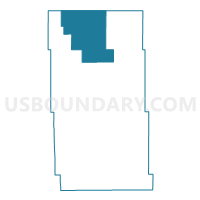
Maps

Graphs
Select a template below for downloading or customizing gragh for North Rushville Precinct, Sheridan County, Nebraska


Neighbors
Neighoring Voting District (by Name) Neighboring Voting District on the Map
- Hay Springs Precinct, Sheridan County, NE
- South Rushville Precinct, Sheridan County, NE
- VTD-precinct 2 PineRidge, Shannon County, SD
- VTD-precinct 3 PineRidge, Shannon County, SD
- VTD-precinct Batesland, Shannon County, SD
- West Gordon Precinct, Sheridan County, NE
- Wounded Knee Precinct, Sheridan County, NE
Top 10 Neighboring County Subdivision (by Population) Neighboring County Subdivision on the Map
- West Shannon UT, Shannon County, SD (8,153)
- Hay Springs precinct, Sheridan County, NE (951)
- Rushville city, Sheridan County, NE (890)
- North Rushville precinct, Sheridan County, NE (445)
- West Gordon precinct, Sheridan County, NE (199)
- Wounded Knee precinct, Sheridan County, NE (178)
- South Rushville precinct, Sheridan County, NE (124)
Top 10 Neighboring Place (by Population) Neighboring Place on the Map
Top 10 Neighboring Unified School District (by Population) Neighboring Unified School District on the Map
- Shannon County School District 65-1, SD (13,586)
- Chadron Public Schools, NE (7,545)
- Gordon-Rushville Public Schools, NE (4,465)
Top 10 Neighboring State Legislative District Lower Chamber (by Population) Neighboring State Legislative District Lower Chamber on the Map
Top 10 Neighboring State Legislative District Upper Chamber (by Population) Neighboring State Legislative District Upper Chamber on the Map
Top 10 Neighboring 111th Congressional District (by Population) Neighboring 111th Congressional District on the Map
Top 10 Neighboring Census Tract (by Population) Neighboring Census Tract on the Map
- Census Tract 9409, Shannon County, SD (4,422)
- Census Tract 9405, Shannon County, SD (4,419)
- Census Tract 9517, Sheridan County, NE (3,254)
- Census Tract 9516, Sheridan County, NE (2,215)
Top 10 Neighboring 5-Digit ZIP Code Tabulation Area (by Population) Neighboring 5-Digit ZIP Code Tabulation Area on the Map
- 69337, NE (7,365)
- 57770, SD (5,271)
- 69343, NE (2,538)
- 69360, NE (1,361)
- 69347, NE (1,249)
- 69365, NE (44)